


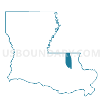
Precinct 114, Tangipahoa Parish, Louisiana
About
Outline

Summary
| Unique Area Identifier | 590987 |
| Name | Precinct 114 |
| County | Tangipahoa Parish |
| State | Louisiana |
| Area (square miles) | 25.77 |
| Land Area (square miles) | 25.69 |
| Water Area (square miles) | 0.07 |
| % of Land Area | 99.71 |
| % of Water Area | 0.29 |
| Latitude of the Internal Point | 30.70263520 |
| Longtitude of the Internal Point | -90.37742380 |
Maps


Graphs
Select a template below for downloading or customizing gragh for Precinct 114, Tangipahoa Parish, Louisiana


Neighbors
Neighoring Voting District (by Name) Neighboring Voting District on the Map
- Precinct 106A, Tangipahoa Parish, LA
- Precinct 110, Tangipahoa Parish, LA
- Precinct 112, Tangipahoa Parish, LA
- Precinct 116, Tangipahoa Parish, LA
- Precinct 118, Tangipahoa Parish, LA